MAP LITERACY
Since maps are an integral component of the study of culture regions in Grade 6 World Cultures, I though it would be a good idea to explore the idea of “map literacy.” Literacy refers to the ability to decipher human communication. Most often we think of literacy in terms of text. Images, tables, graphs, charts, and maps are unique forms of communication, which like text also require specialized skills to decipher meaning.
If we approach maps in the world cultures class from the literacy lens, then what specific skills will students need to interpret and create maps? An understanding of map elements comes to mind first. True “map literacy” goes beyond identifying map elements to understanding perspective and scale on maps. Teach students about how color and lines are used on maps to define and differentiate regions or to contrast land from water. Teach students the difference between small scale and large scale maps. Ensure that students understand map insets. Do not assume that they already know this.
As many world cultures teachers have likely discovered, students come with varying degrees of “map literacy.” It is important to calibrate and check for understanding of all students’ “map literacy” early on in the course. Students benefit from instruction on the difference between reading a 2D map versus reading a 3D map, such as a globe or Google Earth. It would be a very good idea to give students a tutorial in how to use Google Earth. While students may come to grade 6 having mastered using the GPS on their phones, map reading is not the same as following the directions given to the user of a GPS. Here are some resources for instruction on map reading.
MENTAL MAPS
Each of the culture region units of the Grade 6 World Culture course includes a performance assessment for creating a mental map. It is a best practice to administer this performance assessment after students have had multiple exposures with maps and information about the culture region. Here is more in-depth information about Mental Maps.
This resource is a great activity for introducing students to mental mapping and perception in the USA/Canada Unit. The activity could be adapted to include Canada or a separate activity could be created based on the Canadian provinces. Mental Mapping and Perception Activity Here are some ideas for using mental maps. 5 Ways to Utilize Mental Maps
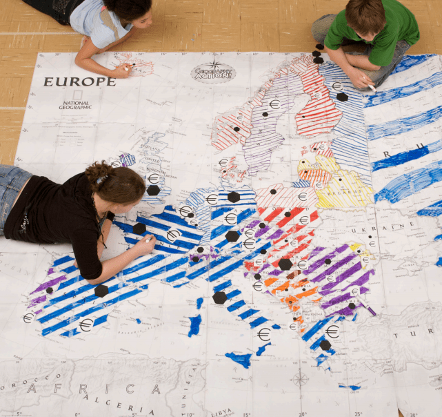
Mega Maps are a great resource for creating maps and are produced by National Geographic. I’ve observed classrooms where students created the mega map and the map was then displayed in the classroom or in a hallway. Some classes can get pretty creative with 3D physical features. The map was then utilized throughout the unit. Smaller versions can also be made for desk top reference.
Mega Maps instructions Mega Map Templates
MOVING FROM MAP READING TO ANALYSIS
True “map literacy” culminates with students’ being able to analyze maps. This is facilitated by questions that prompt students to think about location and patterns. Here are just a few questions that can be adapted based on the type of map being observed.
- What does this map do or tell me? What on the map makes me think this?
- What are the main features of this map?
- Where is ___ located? Why is it there? What is significant about this location?
- What patterns are observed on the map?
- Where are settlements located and where are settlements not located? What physical features on the map facilitate these settlement patterns? How does climate affect this pattern?
- Where are the transportation routes? What is the relationship between physical geography and these patterns?
Proficiency in “map literacy” is key to developing spatial reasoning skills, so be intentional in teaching these skills to your sixth graders and enjoy how fun maps are.